Geospatial 2.0: Will Traditional Players Lead or Follow in the AI and Digital Twin Revolution?

Building on our previous discussions about the shift from services to solutions, the changing skill requirements, and the need to embrace ambiguity, we now turn our attention to the evolving business models in the geospatial industry.

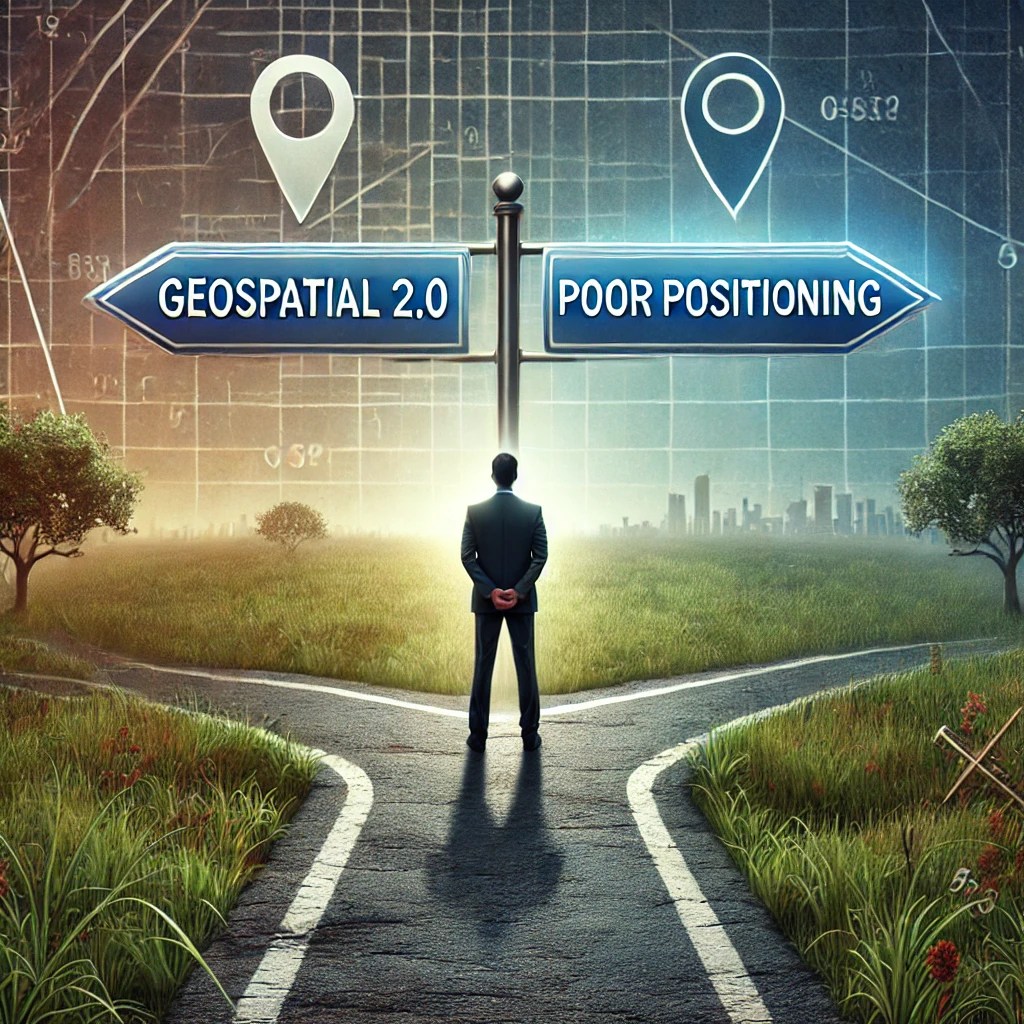
As we move into Geospatial 2.0, with the advance of geospatial data and the AI revolution, are traditional business models becoming outdated?

That is the question we will consider in this article.

Traditional Revenue Streams in Transition

As we’ve explored in our earlier articles, the geospatial industry has long relied on relationship-based sales and personal interactions.

Revenue Generation Methods in GIS & Remote Sensing Companies

The chart above illustrates how relationship sales (35%) and conferences/trade shows (20%) continue to dominate revenue generation methods. While these approaches have served the industry well, they limit growth potential in our increasingly digital and solution-oriented landscape.

The Changing GIS Market Landscape

GIS Market Revenue Distribution by Sector

The concentration of GIS market revenue in the public sector (40%) reflects the industry’s traditional stronghold. However, as we’ve discussed, the future lies in diversifying and adapting to new market needs across both traditional and new sectors.

Digital Twins: A Model for Diversification

Digital Twin Revenue Distribution by Sector

The more diverse sector distribution in the digital twin market offers a guiding path .. maybe! This diversification will continue, with the private sector continuing to grow in importance.

The AI and Digital Twin Challenge

In our last article, we discussed ambiguity in relation to both threat and opportunity. The rise of AI and digital twin technologies represents a prime example of how geospatial companies can turn uncertainty into opportunity. By embracing these technologies, firms could position themselves at the forefront of innovation rather than being sidelined.

Bridging the Sales & Marketing Gap

The low percentage (10%) of revenue generated through digital marketing and content creation underscores the industry’s slow adaptation to modern sales & marketing strategies. This gap presents a significant opportunity for companies willing to innovate in their approach to customer engagement.

My View on the Future

All that being said, the geospatial industry has throughout its history been slow moving. There are relatively few players who control the space. As I look ahead, I see little significant change in the traditional geospatial sector. The industry will remain somewhat fragmented, with Esri dominating the GIS market and a handful of the larger remote sensing companies owning that space. The many geospatial service companies will remain aligned with larger players, and continue to find growth challenging. Overall, I forecast 5-10% annualized growth in the overall sector.

I believe the digital twin market in combination with AI is where we will see considerable growth over the next 5 years. Recreating the world digitally, by combining 3D and 4D data, allows us to understand better and solve real world problems. That has very broad appeal.

I see the geospatial industry introducing digital twins in the verticals it currently dominates; most notably the public sector. Wider adoption I do not see traditional geospatial driving. I think it will play a supporting role.

In the AEC world mergers like Bentley-Cesium have helped fuel my view. Exciting possibilities here; we will see how it plays out. But overall, I sense that we will see new players entering and driving this emerging market. Indeed, given the many moving parts, this may well not be a single organization but a complimentary group, each bringing their own expertise to the table. This group of collaborating companies will collectively provide a complete end-to-end solution from a product, services and implementation standpoint.

This will mean that traditional sales models will need to be refined as the customer can now be both the consumer of the solution as well as members of the ecosystem that create the solution.

Where and how will geospatial play a part in these new ecosystems?

Larger diversified professional services firms, who have geospatial and subject matter expertise in-house, I believe will provide the geospatial muscle to these groups.

More on this topic of sales ecosystems in a future article.

Conclusion

I believe the geospatial industry stands at a pivotal point of convergence between traditional practices and emerging technologies. Success in this new landscape will require not only technical expertise but also the ability to adapt business models, embrace new marketing approaches, and navigate the ambiguity inherent in rapid technological change.

It is my belief that the real growth opportunities lie in integrating AI, digital twin technologies, and other emerging tech with geospatial expertise. In this article, I have shared my doubts about the traditional geospatial industry leading this revolution from the front. I am happy to be proven wrong.

Whatever the future holds, those who can balance their deep geospatial knowledge with these new imperatives will be best positioned to shape the future of the industry in the era of Geospatial 2.0.

Matt Sheehan is a Strategic Growth Advisor helping companies discover and win new Geospatial 2.0 Blue Ocean opportunities in this age of dynamic geospatial digital twins and AI.

The Geospatial Industry: The Seismic Shift from Services to Solutions

The geospatial industry stands at a critical juncture, poised for significant growth yet grappling with fundamental challenges. As we enter the era of Geospatial 2.0, companies face the daunting task of transitioning from traditional service-oriented models to more scalable, solution-driven approaches.

Current State of the Industry

The global geospatial market is experiencing rapid expansion, with projections indicating growth to $147.6 billion in the next five years

This surge is driven by technological advancements, increasing adoption across various sectors, and the integration of geospatial data with emerging technologies like IoT and big data.

Traditionally, many geospatial companies have operated on a service-oriented model, relying heavily on existing relationships and providing setup, data conversion, configuration and other custom services and solutions. While this approach has served the industry well in the past, it now presents limitations in terms of scalability and market reach.

Today, many companies still rely on existing relationships which hinders the ability to explore new markets and scale beyond existing clients. Service oriented teams usually work in a reactive (delivery) rather than proactive (opportunity) mode. Those with a growth innovation mindset are often missing; that is the ability to apply design thinking, discover product-market fit and build/execute successful go-to-market strategies. Sales and marketing struggle to communicate the value proposition, too often falling back on technical jargon which does not resonate with a wider audience.

The reality for many geospatial companies are flat revenues and a struggle with grow.

The Shift to Geospatial 2.0

Geospatial 2.0 represents a paradigm shift in how location-based data and technologies can be utilized and commercialized. Companies are beginning to move away from service-centric models to offer comprehensive solutions that address specific industry challenges.

We have entered a phase of technological integration, where new data collection methods combined with AI, machine learning, and cloud computing is transforming how geospatial data is being analyzed, and applied. This is opening up new opportunities in sectors such as agriculture, transportation, energy, and urban planning.

The Impact of AI and GenAI

Artificial Intelligence (AI) and Generative AI (GenAI) are playing an increasingly crucial role in shaping Geospatial 2.0. These technologies are revolutionizing the industry in several ways:

  1. Data Processing and Analysis: AI algorithms can process vast amounts of geospatial data at unprecedented speeds, identifying patterns and insights that would be impossible for humans to discern manually.
  2. Predictive Modeling: AI enables more accurate predictive modeling for various applications, from urban planning to climate change impact assessment.
  3. Automated Feature Extraction: AI can automatically identify and extract features from satellite imagery and other geospatial data sources, significantly reducing manual labor.
  4. Natural Language Processing: GenAI is enabling more intuitive interfaces for geospatial systems, allowing users to interact with complex spatial data using natural language queries.
  5. Synthetic Data Generation: GenAI can create synthetic geospatial datasets for testing and training purposes, addressing data scarcity issues in some domains.

As these technologies continue to evolve, they will undoubtedly play a pivotal role in driving innovation and creating new opportunities in the geospatial sector.

The Geospatial Growth Triad

Despite the promising outlook, many geospatial companies struggle to capitalize on these opportunities. The transition from a service-centric model to a solution-oriented approach presents many challenges.

To navigate these challenges and seize the opportunities presented by Geospatial 2.0, companies need a comprehensive approach. This is where the Geospatial Growth Triad comes into play, focusing on three interconnected areas:

  1. Opportunity Discovery: At the core of the triad, this involves identifying new markets for existing products or developing new products to meet emerging needs.
  2. Strategy Development: Building solid strategies based on industry best practices to guide the company’s direction and resource allocation.
  3. Go-to-Market Execution: Implementing effective sales and marketing strategies to reach new customers and communicate the value of geospatial solutions.

By addressing these three areas in concert, geospatial companies can position themselves to thrive in the evolving landscape of Geospatial 2.0.

Conclusion

As the industry continues to evolve, those who can successfully navigate the transition from service-oriented models to solution-driven approaches will be best positioned to capitalize on the immense opportunities that lie ahead. The Geospatial Growth Triad offers a framework for companies to tackle this transition systematically, ensuring they remain competitive and relevant in this dynamic market.

Embracing this triad approach is not just beneficialโ€”it’s becoming increasingly necessary for survival and growth in the new era of geospatial technology. By focusing on opportunity discovery, strategy development, and effective go-to-market execution, companies can unlock new revenue streams, expand their market reach, and fully leverage the potential of Geospatial 2.0. As we move forward, the ability to adapt and innovate using frameworks like the Geospatial Growth Triad will be a key differentiator between industry leaders and those left behind in this rapidly evolving landscape.

Interested in learning more about the Geospatial Growth Triad?

Read our new eBook which breaks down the key elements of the Triad. Sign up for a free consultation.

Is AEC now a Geospatial Battleground & Is that Intensified by Recent Mergers?

The geospatial industry is undergoing significant changes as traditional GIS and remote sensing companies merge with technology providers, fueling innovation. NV5โ€™s acquisition of Axim Geospatial, an Esri partner, is part of this transformation and offers some interesting potential benefits to Esri in its pursuit to expand its 3D capabilities and grow its presence in the Architecture, Engineering, and Construction (AEC) sector. However, this effort is complicated by the Bentley-Cesium merger, which poses a competitive threat to Esriโ€™s ambitions, given Bentleyโ€™s deep integration into AEC workflows. Letโ€™s explore these dynamics and how they could shape the future of geospatial business growth in the AEC industry.

Esriโ€™s Focus on 3D and AEC Expansion

Esri has been heavily investing in 3D technologies to expand its presence in the AEC industry. Tools such as ArcGIS Reality, ArcGIS Urban, and ArcGIS Indoors are part of its push to evolve its GIS adoption strategies from traditional mapping to more advanced 3D visualization and digital twin capabilities. This shift is a key aspect of Geospatial 2.0, where 3D models and real-time data integration are essential in infrastructure and urban planning.

Esriโ€™s partnership with Axim could provide a significant boost here. NV5 and Axim, with their remote sensing capabilities, can produce high-quality 3D outputs using technologies like LiDAR and high-resolution imagery. These 3D datasets, when integrated with Esriโ€™s platforms, can offer a richer, more detailed experience for AEC clients, helping Esri build out its enterprise geospatial solutions for infrastructure projects in this evolving Geospatial 2.0 landscape.

NV5โ€™s 3D Capabilities: A Boost for Esri?

As a remote sensing powerhouse, NV5 can generate high-fidelity 3D data that is invaluable in AEC workflows. Integrating this data into Esriโ€™s ArcGIS ecosystem can enhance Esriโ€™s 3D visualization and analysis capabilities, making it more relevant to location intelligence for business and AEC applications. The ability to collect and process real-time data from the physical world, combined with Esriโ€™s spatial analytics for decision-making, positions Esri well to address the demands of Geospatial 2.0, where merging diverse data sources creates actionable insights for infrastructure projects.

However, the AEC sector traditionally operates with tools like Bentleyโ€™s MicroStation and iTwin platform, which are deeply embedded in engineering workflows. Even if Esri can enhance its 3D capabilities through its partnerships with NV5 and Axim, Bentleyโ€™s long-standing presence and familiarity in the AEC industry pose a major challenge.

Bentleyโ€™s Competitive Advantage in AEC

The Bentley-Cesium merger significantly bolsters Bentleyโ€™s position in the AEC sector. Bentley already dominates the AEC digital twin space with its iTwin platform, which allows users to integrate real-time data and 3D models for infrastructure design, monitoring, and maintenance. By adding Cesiumโ€™s cutting-edge 3D geospatial visualization technology to the mix, Bentley now has an even more powerful toolset to offer AEC clients. Cesiumโ€™s 3D Tiles standard is well-suited for rendering complex geospatial datasets, which is crucial for large-scale infrastructure projects and smart city initiatives.

Bentleyโ€™s long-standing relationships with AEC firms, which have relied on its tools for years, give it a significant competitive edge over Esri. Engineers are familiar with Bentleyโ€™s workflows, and integrating Esriโ€™s GIS tools into these engineering-heavy environments is often seen as secondary or supplementary. Even in firms that use GIS, it is often confined to GIS departments, separate from the core engineering teams that handle project design and execution. This compartmentalization limits Esriโ€™s penetration into AEC.

The Path Forward: Can Esri Overcome Bentleyโ€™s Lead?

While NV5โ€™s 3D capabilities can help Esri enhance its offerings for the AEC sector, Bentley still holds a strategic advantage due to its deep integration into engineering workflows. For Esri to successfully compete, it must:

  • Bridge the GIS and engineering gap: Esri needs to make its tools more accessible to engineers and project managers in AEC firms, demonstrating the value of spatial analytics for decision-making beyond just GIS departments.
  • Focus on interoperability: If Esriโ€™s platforms can seamlessly integrate with engineering software like Bentleyโ€™s MicroStation and iTwin, it could reduce friction and encourage more adoption within AEC.
  • Enhance 3D and digital twin solutions: Esri must continue improving its 3D capabilities to match the engineering-specific needs of the AEC industry, especially as it seeks to provide end-to-end solutions like Bentley-Cesium. Strengthening its position in the Geospatial 2.0 era will also be essential to offering the cutting-edge capabilities required by modern infrastructure projects.

Ultimately, while NV5โ€™s acquisition of Axim and its relationship with Esri can drive organic growth and strengthen Esriโ€™s 3D offerings, the Bentley-Cesium merger still poses a significant challenge. Bentleyโ€™s established presence and familiarity with AEC workflows give it a head start, making it difficult for Esri to fully penetrate the AEC spaceโ€”especially if GIS remains siloed within specific departments rather than fully integrated into engineering processes.

Conclusion

The NV5-Axim merger brings valuable 3D capabilities that can help Esri expand its reach in the AEC industry, especially as the demand for digital twins and real-time infrastructure monitoring grows. However, Bentleyโ€™s dominance in the AEC space and its deep integration into engineering workflows give it a strong competitive advantage. While Esri can leverage NV5โ€™s remote sensing data and grow its 3D capabilities, it faces an uphill battle in bridging the gap between traditional GIS and the engineering-driven world of AEC. To compete with Bentley-Cesium, Esri will need to ensure that its tools offer seamless integration and provide real, tangible value to engineersโ€”beyond the GIS department.d of AEC. To compete with Bentley-Cesium, Esri will need to ensure that its tools offer seamless integration and provide real, tangible value to engineersโ€”beyond the GIS department.

Want to stay at the forefront of geospatial innovation and growth strategies? Subscribe to my monthly ‘Geospatial Growth Insights’ newsletter for exclusive industry analysis, growth tips, and early access to my latest thought leadership articles: Subscribe here.

The NV5-Axim Merger: Will the One-Stop-Shop Strategy Drive GIS Growth or Just Capture Market Share?

As the geospatial industry evolves, NV5 Global, Inc. has positioned itself at the forefront through a series of strategic acquisitions, most notably Axim Geospatial. This merger is part of a broader effort by NV5 to transition from a collection of specialized service providers to a comprehensive, end-to-end geospatial solutions provider. But will this one-stop-shop strategy help drive geospatial business growth, or is NV5โ€™s success more likely to come from winning business away from smaller, more specialized competitors in the short term?

The One-Stop-Shop Advantage

NV5โ€™s acquisition of Axim Geospatial reflects the growing trend in the industry toward consolidation and integrated services. This shift allows clients to engage with a single provider for all their geospatial needs, from location intelligence for business and cloud services to advanced analytics and infrastructure security solutions. For industries like defense, utilities, and infrastructure, this is a major advantage. NV5โ€™s comprehensive approach eliminates the need to juggle multiple vendors, reducing both operational complexity and cost.

This holistic service offering aligns perfectly with the ongoing move towards Geospatial 2.0, where the integration of GIS, AI, IoT, and remote sensing into cohesive platforms is increasingly sought after by industries that need real-time, actionable insights.

Addressing Organic GIS Growth Challenges

The traditional GIS market has faced slow organic growth, largely because the services were fragmented. Many companies, especially in industries that could benefit from GIS, were deterred by the complexity of integrating multiple specialized solutions. NV5โ€™s one-stop-shop model can overcome this challenge by providing everything a client needs under one roof.

  • Simplified Client Experience: With NV5 offering an integrated solution, clients no longer need to source geospatial data from one vendor, analytics from another, and infrastructure management from yet another. This simplification opens the door for new companies to explore GIS adoption strategies as part of their business strategy.
  • Increased Efficiency: By integrating data collection, analysis, and visualization into a single service, NV5 offers significant efficiencies to industries that rely on geospatial insights. This added value can attract new sectors into the GIS fold, boosting spatial analytics for decision-making and fostering the enterprise geospatial solutions market.

By reducing the complexity and barriers to entry, NV5’s comprehensive model could help the GIS sector tap into previously underserved markets, driving organic growth over time.

Winning Business From Other Service Providers

While NV5โ€™s strategy could foster organic growth in the long run, the short-term impact is likely to be seen in the competition for market share. As a one-stop-shop, NV5 has the potential to win business away from smaller, specialized geospatial service providers.

  • Client Consolidation: Many companies currently working with multiple geospatial vendors will likely consolidate their needs into a single provider to save time and reduce complexity. NV5โ€™s ability to offer full-service geospatial solutions will attract clients who value streamlined operations and cost savings.
  • Competitive Differentiation: NV5 is differentiating itself from the competition by offering not just services, but integrated, scalable solutions. In contrast, smaller service providers may struggle to compete with the breadth of services NV5 can offer, pushing some clients to make the switch.

The Long-Term Outlook

The one-stop-shop strategy offers a clear path for NV5 to capture market share in the short term by providing greater value to clients looking to reduce vendor fragmentation. Over time, however, this approach could also stimulate geospatial business growth as the simplified, integrated offerings lower the barriers to entry for new customers.

In this sense, NV5โ€™s one-stop-shop model not only positions the company to win in the short term but also helps expand the GIS market by making geospatial solutions more accessible and attractive to a broader range of industries. This is especially important in the context of Geospatial 2.0, where the integration of geospatial data, AI, and IoT is driving innovation and growth across multiple sectors.

One Note of Caution

The idea of a one-stop-shop is attractive both from an NV5 growth perspective, and for customers looking for a simple path to a solution. But successfully merging companies with quite different approaches, technology and business processes can be very difficult. Acquisitions look good on the balance sheet, but success requires an integration plan. That is both internal and external.

Change can be tough, and it takes far sighted, decisive leadership, with a solid strategy to move organizations forward.

Conclusion

The NV5-Axim Geospatial merger highlights the increasing demand for integrated, end-to-end geospatial solutions. In the short term, NV5 is poised to capture market share from smaller service providers by offering clients a more convenient and comprehensive package. In the long term, however, this one-stop-shop strategy has the potential to drive organic growth in the GIS industry by lowering barriers to entry and attracting new sectors to adopt geospatial technologies.

As the industry continues to evolve toward more integrated and scalable solutions, NV5โ€™s approach could become the model for success in the era of Geospatial 2.0.


Want to stay at the forefront of geospatial innovation and growth strategies? Subscribe to my monthly ‘Geospatial Growth Insights’ newsletter for exclusive industry analysis, growth tips, and early access to my latest thought leadership articles: Subscribe here.

Overcoming GIS Growth Challenges: Moving Beyond Mapping to Enterprise Solutions

Geographic Information Systems (GIS) are powerful tools for mapping and spatial analysis, yet they have struggled to expand beyond specialized departments into widely adopted enterprise geospatial solutions. Often seen as a mapping tool rather than a comprehensive business solution, GIS faces several challenges in becoming integral to business intelligence. This article explores why GIS growth has been slow and how it can overcome these barriers to unlock its potential in location intelligence for business.

Perception as a Niche Tool

One of the primary obstacles to GIS adoption strategies is its limited perception as a mapping technology. Despite advancements in geospatial analytics, many organizations still see GIS as useful only for creating maps, rather than applying it to broader business problems.

Many business leaders are unaware of the potential for GIS to offer location intelligence, predictive analytics, and operational efficiency. This lack of awareness has led to underutilization, particularly in sectors that donโ€™t immediately see the connection between geography and business operations.

Siloed GIS Departments

In many organizations, GIS is confined to specific departments like urban planning or infrastructure. This siloed approach has prevented GIS from being adopted across other business areas, such as marketing, supply chain, or finance, where it could provide valuable insights.

The lack of integration has restricted GIS from becoming part of enterprise-wide decision-making, limiting its potential to contribute to market trends and customer behavior analysis.

Limited Integration with Enterprise Systems

A major barrier to GIS adoption is its difficulty in integrating with existing enterprise systems like ERP or CRM. Many GIS platforms, such as ArcGIS, are excellent for spatial analysis but donโ€™t easily integrate with the systems businesses rely on for their day-to-day operations. This lack of seamless integration prevents GIS from being embedded into business workflows.

Cost and Complexity

For many small-to-medium-sized businesses, the cost and complexity of implementing GIS can be prohibitive. The investment required for both software and skilled personnel can seem daunting, especially when the value of GIS is not immediately apparent. The learning curve for using geospatial tools can also discourage broader adoption, especially in industries where geospatial analysis is not part of the organizational culture.

Private Sector Struggles

While GIS has seen success in the public sector, private sector adoption remains limited. Industries like finance, retail, and healthcare have not fully realized the value of GIS, despite its potential to optimize location-based services and infrastructure management.

For GIS to grow in the private sector, it must be seen as a tool for solving business problems, not just for generating maps.

Moving Forward with Geospatial 2.0

Geospatial 2.0 offers a path forward by integrating GIS with remote sensing, AI, and IoT, to create a more accessible and flexible geospatial ecosystem. This evolution addresses the barriers to adoption by making geospatial tools more user-friendly and cost-effective while integrating them with existing business systems.

Embracing Geospatial 2.0 allows organizations to leverage location intelligence across their operations and unlock the full potential of enterprise geospatial solutions.

Overcoming the Challenges

To ensure GIS becomes a mainstream enterprise solution, organizations can take the following steps:

  • Broader Awareness: Educate business leaders on how GIS offers actionable insights beyond mapping, including supply chain optimization and market analysis.
  • User-Friendly Interfaces: GIS platforms need to continue to evolve with more intuitive, non-technical interfaces to make them accessible to a wider range of users. Reducing the complexity of GIS tools will enable broader adoption across different departments, from marketing to finance.
  • Seamless Integration: Ensure GIS integrates smoothly with existing systems like ERP and CRM, making it a natural part of broader business workflows.
  • Cloud Solutions: Leverage cloud-based GIS to reduce costs, increase scalability, and make the technology accessible to businesses of all sizes.
  • Cultural Shift: Encourage businesses to adopt geospatial insights as part of everyday decision-making, breaking down silos between GIS departments and other parts of the organization.

Conclusion

GIS is more than a mapping toolโ€”itโ€™s a powerful enabler of business growth through location intelligence and spatial analytics for decision-making. By addressing the barriers to adoption and embracing Geospatial 2.0, organizations can fully integrate GIS into their enterprise solutions, allowing for better decision-making and a deeper understanding of their business environments.


Want to stay ahead of the curve in geospatial innovation? Subscribe to my ‘Geospatial Growth Insights’ newsletter for exclusive industry analysis and tips on driving growth with geospatial strategies: Subscribe here.

How Does the Bentley-Cesium Deal Reshape the Geospatial Competitive Landscape?

In a noteworthy move within the geospatial and infrastructure sectors, Bentley Systems has acquired Cesium, a leader in 3D geospatial data visualization and a champion of open-source technologies. This acquisition brings together Bentley’s renowned expertise in infrastructure engineering and Cesium’s innovative 3D geospatial platform, raising important questions about how this deal will impact the competitive dynamics in the geospatial industry. As digital twins, smart cities, and large-scale infrastructure projects increasingly demand the seamless integration of geospatial data and engineering insights, this partnership could reshape both companies’ competitive positioning, especially in relation to industry giants like Esri.

But will this acquisition significantly shift the geospatial competitive landscape? To answer that, let’s break down the implications of this deal and how it aligns with the emerging concept of “Geospatial 2.0.”

Bentley Systems and Cesium: Complementary Strengths

Bentley Systems has long been a major player in infrastructure engineering software, serving industries such as construction, transportation, and urban planning. Its iTwin platform has gained traction as a leading solution for creating digital twinsโ€”virtual representations of physical assets used for design, construction, and operational management. With iTwin, Bentley provides a comprehensive platform for managing infrastructure data at every stage of the lifecycle.

Cesium, on the other hand, has made a name for itself as a pioneer in 3D geospatial technology. Through its CesiumJS and 3D Tiles open-source projects, it has enabled developers to visualize massive geospatial datasets in real time. Cesium’s core strength lies in rendering high-precision 3D models of both built and natural environments at scale, offering crucial tools for industries such as defense, urban planning, and real estate.

By combining these complementary strengths, Bentley and Cesium are poised to provide a more unified solution for users looking to merge the best of infrastructure engineering and geospatial data management. This aligns perfectly with the Geospatial 2.0 concept, which emphasizes breaking down silos between different data types and technologies to create more comprehensive, customer-centric solutions.

A Closer Look at the Competitive Landscape: Esri and Beyond

Esri, a dominant force in the GIS space, has long been a leader in geospatial mapping and analysis through its flagship ArcGIS platform. Esri’s tools enable businesses and governments to map, analyze, and make decisions based on geographic data. While Esri has also made strides in 3D visualization and digital twins with products like ArcGIS Reality, ArcGIS Urban and ArcGIS Indoors, its primary focus remains on geographic information systems (GIS) and spatial data analysis.

Bentley’s acquisition of Cesium could be seen as an attempt to bridge the gap between geospatial data and engineering data in ways that might outpace Esri in certain sectors. While Esri excels in GIS and spatial analysis, the integration of Cesium’s 3D geospatial visualization capabilities with Bentley’s infrastructure-focused iTwin platform creates a more comprehensive solution for industries like architecture, engineering, construction, and operations (AECO).

Digital Twins: The New Frontier of Competition

The digital twin space is one of the key battlegrounds that will see heightened competition as a result of this acquisition. Both Esri and Bentley have been making inroads into digital twin technology, but the combination of Cesium’s high-fidelity 3D geospatial models and Bentley’s infrastructure management platform could give the latter an edge, especially in large-scale infrastructure projects.

Digital twins require a seamless blend of data from multiple domainsโ€”geospatial, subsurface, IoT, and engineeringโ€”and Cesium’s platform is designed to handle and visualize these massive datasets with precision and accuracy. By integrating Cesium’s capabilities, Bentley’s iTwin platform will be able to offer users an even more holistic and detailed view of complex infrastructure projects, extending from the surface level down to subsurface environments.

This integration is a prime example of the Geospatial 2.0 philosophy, which focuses on creating customer-centric solutions by combining various data sources and technologies. For instance, in smart city management, urban planners could use the integrated Bentley-Cesium platform to create comprehensive digital twins of entire urban areas, enabling real-time monitoring of traffic flow, energy consumption, and infrastructure health.

Open Ecosystems: A Differentiating Factor

One of the most significant aspects of this acquisition is Cesium’s commitment to open ecosystemsโ€”open standards, open APIs, and open-source tools. This aligns with Bentley’s increasing focus on open ecosystems, particularly through its iTwin platform, which is built to be interoperable with a wide range of data sources and software tools.

This emphasis on openness and interoperability is a key tenet of Geospatial 2.0, as it allows for greater flexibility and integration across different platforms and tools. It enables developers and enterprises to create customized solutions that address specific customer needs, rather than being limited by proprietary systems.

Implications for the Future of the Geospatial Industry

The Bentley-Cesium acquisition represents a significant step towards realizing the vision of Geospatial 2.0. By combining the strengths of 3D geospatial data, digital twins, and real-time data, this partnership paves the way for more integrated, scalable, and customer-centric solutions.

As the geospatial industry continues to evolve, the focus will shift from purely technological innovations to delivering value through comprehensive, real-time insights that solve critical infrastructure challenges. Companies that can navigate the challenges of integration, data security, and user adoption while delivering tangible value to their customers will be well-positioned to lead in this new era.

The future of the geospatial industry may hinge on how companies continue to evolve their technologies and ecosystems, and which can provide the most comprehensive, open, and scalable solutions for their users. The Bentley-Cesium acquisition sets a new standard for what’s possible when geospatial technology is fully integrated with engineering and real-time data, potentially reshaping the competitive landscape and pushing the entire industry towards a more holistic, problem-solving approach.

Matt Sheehan is a geospatial thought leader whose focus is on helping geospatial companies grow. Reach him at matt@genaimarketers.com

Navigating Geospatial 2.0: Why Poor Positioning is Holding Back Many Geospatial Companies

As geospatial marketing experts at GenAI Marketers, we’ve seen firsthand how crucial proper positioning is for startups in this space. Let us share our approach to positioning geospatial companies for success.

First and foremost, we believe effective positioning boils down to answering one key question: “Why pick us over the other guys?” In the geospatial sector, where technical innovation is rapid and competition is fierce, this question becomes even more critical.

Many geospatial startups we work with initially focus solely on their technical capabilities – the resolution of their LiDAR systems or the accuracy of their remote sensing algorithms. But that’s not enough. We encourage our clients to put themselves in the shoes of their buyers and think about how to position against everyone else in the market.

One of the key indicators we look for in successful positioning is how quickly a customer understands the sales pitch. In our industry, this could mean the difference between a CEO immediately grasping how your earth observation data can transform their decision-making processes, versus being lost in technical jargon about spectral bands and resolution.

When we evaluate a geospatial company’s website or marketing materials, we’re looking for two key things: What unique value can you deliver that no one else can? And is it immediately clear who this is for? We ensure that our clients’ homepages communicate these points clearly and concisely.

One of the most crucial insights we’ve gained over years of working with geospatial companies is understanding the concept of “customer indecision.” In the B2B space, which includes many geospatial technology buyers, fear of making a wrong decision often paralyzes potential customers. In fact, 40% to 60% of B2B purchase processes end in no decision.

For geospatial startups, this means doing more than just showcasing amazing technology. We help our clients provide clear, compelling reasons why choosing their solution is a safe, smart decision. This could involve highlighting case studies of successful implementations, offering trials or pilots, or providing robust support and training programs.

We always stress to our clients the importance of understanding and focusing on a specific market segment. In the geospatial world, this might mean zeroing in on a particular application area โ€“ like precision agriculture, smart cities, or disaster response โ€“ rather than trying to be all things to all potential users of spatial data.

In our experience, the most successful geospatial companies find an underserved subsegment of the market, dominate it, and then expand from there. For instance, we might guide a client to become the go-to provider of spatial analytics for renewable energy projects before branching out to other sectors.

At GenAI Marketers, we remind our clients that effective positioning for geospatial startups isn’t just about having the most advanced technology. It’s about clearly communicating the unique value you bring to specific customers, addressing their fears and uncertainties, and carving out a distinct space in the market.

When we work with geospatial entrepreneurs, we ensure that when they pitch their solutions, customers immediately understand not just what they’re offering, but why it matters. This approach has consistently led to more effective marketing, shorter sales cycles, and accelerated growth for the geospatial companies we advise.

Are We In The Midst of a Commercial Revolution in Geospatial?

Executive Summary

The geospatial industry is on the cusp of a major transformation, dubbed “Geospatial 2.0.” This evolution is characterized by the convergence of GIS and remote sensing technologies, the integration of AI and machine learning, and a shift in commercial strategies. This article explores the current state of the industry, the challenges it faces, and the opportunities that lie ahead for geospatial companies looking to accelerate their growth in this new era.

The Evolution of Geospatial Technology

The geospatial industry has undergone significant changes over the past few decades:

  1. 1990s – 2000s: Transition from desktop to web-based GIS
  2. Late 2000s – 2010s: Mobile revolution with GPS-enabled smartphones and tablets
  3. Present day: Geospatial 2.0 – Integration of multidimensional data (2D, 3D, 4D) and AI automation

This latest phase, Geospatial 2.0, represents the most significant leap forward, building upon the foundations laid by previous technological advancements.

The Current State of the Geospatial Industry

Historically, the geospatial industry has been divided into two main sectors:

  1. GIS (Geographic Information Systems): Primarily focused on 2D mapmaking and spatial analysis, often relying on software platforms like Esri.
  2. Remote Sensing: Centered around data collection and processing, producing data products such as LiDAR point clouds for applications like vegetation management along power lines.

Many geospatial companies, particularly in the GIS sector, have operated as service providers, often partnering with platform vendors like Esri. On the remote sensing side, companies have primarily focused on selling data products.

The Emergence of Geospatial 2.0

Geospatial 2.0 is characterized by several key trends:

  1. Mergers and Acquisitions: GIS and remote sensing companies are joining forces, as exemplified by a number of recent mergers. This integration brings together the “vehicle” (GIS platforms) and the “fuel” (remote sensing data).
  2. Shift towards Product Development: Many service-oriented companies are now exploring product development to create new revenue streams.
  3. AI and Machine Learning Integration: These technologies are automating processes and enabling new capabilities in both data processing and analysis.
  4. Commercial Strategy Evolution: There’s a growing recognition of the need for better integration between sales, marketing, and product development teams.

Challenges in the Commercial Landscape

Despite technological advancements, many geospatial companies face commercial challenges:

  1. Sales-Led Approach: Many companies still rely heavily on traditional sales techniques with limited marketing support.
  2. Disconnected Teams: There’s often a lack of coordination between sales, marketing, and product development teams.
  3. Product Development Issues: Many products fail to gain traction beyond the MVP stage due to insufficient commercial input during development.
  4. Slow Adoption of New Technologies: Many geospatial companies are lagging in adopting tools like generative AI for marketing and sales.

The Path Forward: Integrating Commercial Strategies

To succeed in the Geospatial 2.0 era, companies need to focus on:

  1. Breaking Down Silos: Fostering closer collaboration between sales, marketing, and product teams.
  2. Product-Market Fit: Ensuring commercial perspectives are integrated into product development from the start.
  3. Unified Storytelling: Developing consistent narratives that span the entire customer journey, from marketing to sales.
  4. Embracing AI: Leveraging generative AI and machine learning not just for data processing, but also for marketing, sales, and product development.
  5. Adapting Go-to-Market Strategies: Developing new approaches that align with the integrated nature of Geospatial 2.0 technologies.

Conclusion

The geospatial industry is at a pivotal moment. The technological foundations for Geospatial 2.0 are in place, but commercial strategies need to evolve to fully capitalize on these advancements. By breaking down internal silos, embracing new technologies like AI, and developing integrated go-to-market strategies, geospatial companies can position themselves for accelerated growth in this new era.

As the industry continues to mature, those companies that can effectively bridge the gap between technological innovation and commercial execution will be best positioned to lead in the Geospatial 2.0 landscape.

Art GenAI Marketers we are commercial geospatial experts, working with sales, marketing and product teams to drive growth.

Contact me Matt Sheehan at matt@genaimarketers.com for more information.

Are Commercial Challenges Holding Back the Geospatial Industry?

The geospatial industry has undergone significant transformations over the past three decades, with each phase bringing new challenges and opportunities. As we enter what many consider the third major phase of evolution in this field, it’s crucial to understand the current landscape and the hurdles that companies face in navigating this rapidly changing terrain.

The Journey So Far

The geospatial industry has seen three major phases of evolution:

  1. The rise of WebGIS in the 1990s and early 2000s
  2. The emergence of mobile computing and GPS-enabled devices
  3. The current phase, characterized by massive data collection, multidimensional data, and the emergence of Artificial Intelligence (AI)

This latest phase represents a significant inflection point, potentially more impactful than the previous two combined. The industry is now grappling with the challenges and opportunities presented by Geospatial 2.0, which involves handling vast amounts of data, including LiDAR and other multidimensional datasets, as well as leveraging new platforms, software, and AI technologies.

Commercial Challenges in the Geospatial Industry

While technological advancements have been rapid, the commercial side of the geospatial industry has faced several persistent challenges. These can be broadly categorized into three main areas:

1. Product-Market Fit

Many geospatial companies struggle with achieving product-market fit, especially when:

  • Introducing existing products to new markets (e.g., moving from Europe to the US)
  • Developing entirely new products

The lack of proper market validation often results in minimum viable products (MVPs) that never make it to market. This issue is frequently exacerbated when technical teams drive product development without sufficient input from commercial teams or end-users.

2. Strategy Formulation

Strategy is often misunderstood or poorly implemented in geospatial companies. Many organizations either rely too heavily on external consultants or fail to develop a comprehensive internal strategy. A well-defined strategy should include:

  • A clear vision and mission
  • Defined target markets
  • A plan for achieving competitive advantage
  • Methods for executing and adapting the strategy

3. Go-to-Market Execution

The execution of sales and marketing strategies presents another significant challenge. Companies often struggle with:

  • Finding the right balance between hiring pure salespeople and geospatial experts
  • Developing effective websites that clearly communicate value propositions
  • Creating targeted content for different stages of the sales funnel
  • Implementing proper call-to-action strategies

The Way Forward

To address these challenges, geospatial companies should consider the following approaches:

  1. Embrace Design Thinking: Implement human-centric frameworks that involve customers in the product development process from the start, ensuring continuous validation and iteration.
  2. Develop Comprehensive Strategies: Utilize frameworks like those proposed by Roger Martin to create robust strategies that define vision, target markets, and competitive advantages.
  3. Improve Go-to-Market Execution: Focus on creating clear, compelling websites, developing targeted content for different stages of the sales funnel, and implementing effective call-to-action strategies.
  4. Leverage AI and Generative AI: Explore the potential of AI technologies to enhance efficiency and effectiveness in product development, marketing, and sales processes.

Conclusion

The geospatial industry stands at a critical juncture, with immense opportunities for growth and innovation. By addressing the commercial challenges head-on and embracing new technologies and methodologies, companies can position themselves for success in this evolving landscape. The key lies in balancing technical expertise with strong commercial acumen, ensuring that cutting-edge geospatial technologies translate into valuable, market-ready solutions.

Matt Sheehan is a geospatial business growth expert. Follow him on LinkedIn.

Geospatial – A Time of Opportunities & Challenges

In the rapidly evolving world of geospatial technology, understanding the industry’s journey is crucial for businesses aiming to leverage its power for growth. This article explores the three major revolutions that have shaped the geospatial landscape, offering insights into how these changes impact market expansion and business strategies in the sector.

The Web GIS Revolution: Democratizing Spatial Data

The late 1990s marked the beginning of a significant shift in the geospatial industry with the advent of Web GIS. This period saw the transition from desktop-based GIS applications to web-based solutions, dramatically expanding access to spatial data and analysis tools.

Key developments:

  • Introduction of map objects and IMS from Esri
  • Efforts to replicate desktop GIS functionality on the web
  • The game-changing introduction of “slippy maps” by Google

This revolution laid the foundation for broader adoption of GIS technologies across various industries, opening new markets and creating opportunities for innovative geospatial solutions.

The Mobile Revolution: GIS in Your Pocket

The second major shift came with the rise of mobile computing, particularly with the introduction of GPS-enabled smartphones and tablets. This revolution brought geospatial capabilities to the masses, fundamentally changing how people interact with location-based information.

Highlights:

  • Integration of GPS in mobile devices
  • Development of mobile GIS applications
  • Challenges in enterprise adoption of mobile GIS solutions

The mobile revolution created new business opportunities in location-based services, field data collection, and real-time spatial analysis, driving market growth in the geospatial sector.

The Data and AI Revolution: Geospatial 2.0

We are currently in the midst of the third and perhaps most transformative revolution in the geospatial industry. This phase is characterized by:

  1. Explosion of multidimensional data (3D, 4D)
  2. Advancements in remote sensing and LiDAR technologies
  3. Integration of AI and machine learning in geospatial analysis

This “Geospatial 2.0” era presents both challenges and opportunities:

  • Managing and analyzing vast amounts of complex spatial data
  • Developing new products and services leveraging AI and multidimensional data
  • Bridging the gap between technical capabilities and commercial applications

The Commercial Challenge in Geospatial Growth

Despite these technological advancements, the geospatial industry faces significant challenges on the commercial front:

  • Limited differentiation among offerings
  • Insufficient marketing and growth strategies
  • Lack of sophistication in sales and marketing approaches compared to other tech sectors

These challenges present opportunities for businesses that can effectively communicate the value of advanced geospatial solutions and develop targeted go-to-market strategies.

Looking Ahead: Strategies for Geospatial Business Growth

As the industry continues to evolve, businesses must adapt their strategies to capitalize on the opportunities presented by Geospatial 2.0:

  1. Focus on developing niche solutions that leverage multidimensional data and AI
  2. Invest in marketing and sales capabilities to effectively communicate complex value propositions
  3. Explore partnerships and collaborations to create integrated solutions
  4. Prioritize user experience in product development, learning from the success of consumer-grade mapping applications

Conclusion

The geospatial industry stands at a critical juncture, with unprecedented opportunities for innovation and growth. By understanding the industry’s evolution and addressing the commercial challenges, businesses can position themselves to thrive in this new era of geospatial technology.

Are you ready to accelerate your geospatial business growth in the age of AI and multidimensional data? Let’s connect and explore how we can translate your technical capabilities into market success. Connect with us at this link.